
Piazza Armerina topographic map
Interactive map
Click on the map to display elevation.
About this map
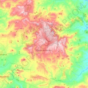
Name: Piazza Armerina topographic map, elevation, terrain.
Location: Piazza Armerina, Enna, Sicily, 94015, Italy (37.29078 14.18345 37.51857 14.52215)
Average elevation: 1,667 ft
Minimum elevation: 689 ft
Maximum elevation: 2,969 ft
Other topographic maps
Click on a map to view its topography, its elevation and its terrain.