
Großrosseln topographic map
Interactive map
Click on the map to display elevation.
About this map
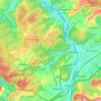
Name: Großrosseln topographic map, elevation, terrain.
Location: Großrosseln, Regionalverband Saarbrücken, Saarland, Germany (49.15128 6.77588 49.21574 6.86194)
Average elevation: 810 ft
Minimum elevation: 604 ft
Maximum elevation: 1,125 ft