
Wald (ZH) topographic map
Interactive map
Click on the map to display elevation.
About this map
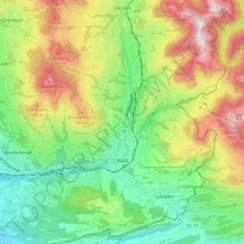
Name: Wald (ZH) topographic map, elevation, terrain.
Location: Wald (ZH), Bezirk Hinwil, Zurigo, Svizzera (47.25281 8.88508 47.31491 8.97500)
Average elevation: 2,618 ft
Minimum elevation: 1,654 ft
Maximum elevation: 4,035 ft