
Charlotteville topographic map
Interactive map
Click on the map to display elevation.
About this map
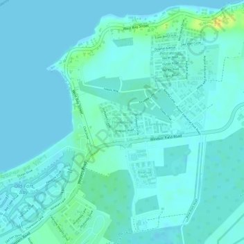
Name: Charlotteville topographic map, elevation, terrain.
Location: Charlotteville, New Providence, The Bahamas (25.04878 -77.49646 25.05359 -77.49098)
Average elevation: 16 ft
Minimum elevation: 0 ft
Maximum elevation: 82 ft
Other topographic maps
Click on a map to view its topography, its elevation and its terrain.
Stanleyville
Stanleyville, New Providence, The Bahamas
Average elevation: 23 ft
Highbury Park
Highbury Park, New Providence, The Bahamas
Average elevation: 23 ft