
Townparks topographic map
Interactive map
Click on the map to display elevation.
About this map
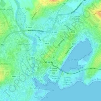
Name: Townparks topographic map, elevation, terrain.
Average elevation: 23 ft
Minimum elevation: -3 ft
Maximum elevation: 92 ft
Other topographic maps
Click on a map to view its topography, its elevation and its terrain.
Castlegar
Ireland > Galway City > Galway City
Castlegar, Galway City, County Galway, Connacht, Ireland
Average elevation: 92 ft