
Žalec topographic map
Interactive map
Click on the map to display elevation.
About this map
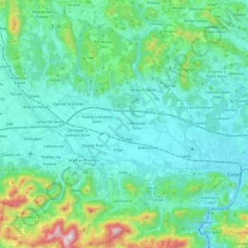
Name: Žalec topographic map, elevation, terrain.
Location: Žalec, Savinja Statistical Region, Slovenia (46.18167 15.09727 46.34065 15.22521)
Average elevation: 1,243 ft
Minimum elevation: 735 ft
Maximum elevation: 3,589 ft