
Amamioshima topographic map
Interactive map
Click on the map to display elevation.
About this map
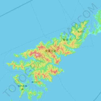
Name: Amamioshima topographic map, elevation, terrain.
Location: Amamioshima, Oshima County, Kagoshima Prefecture, Japan (28.10893 129.13383 28.53088 129.72213)
Average elevation: 128 ft
Minimum elevation: 0 ft
Maximum elevation: 2,244 ft
Other topographic maps
Click on a map to view its topography, its elevation and its terrain.
Wadomari
Wadomari, Oshima County, Kagoshima Prefecture, Japan
Average elevation: 10 ft