
Ritchie topographic map
Interactive map
Click on the map to display elevation.
About this map
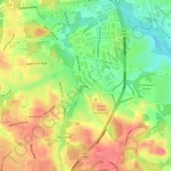
Name: Ritchie topographic map, elevation, terrain.
Average elevation: 194 ft
Minimum elevation: 79 ft
Maximum elevation: 295 ft
Other topographic maps
Click on a map to view its topography, its elevation and its terrain.
Forestville
United States > Maryland > Prince George's County > Forestville
Forestville, Prince George's County, Maryland, United States
Average elevation: 240 ft