
Nauen topographic map
Interactive map
Click on the map to display elevation.
About this map
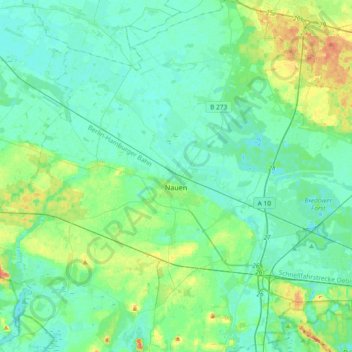
Name: Nauen topographic map, elevation, terrain.
Location: Nauen, Havelland, Brandenburg, Germany (52.50132 12.65240 52.72538 13.01391)
Average elevation: 118 ft
Minimum elevation: 89 ft
Maximum elevation: 220 ft