
Northbridge topographic map
Interactive map
Click on the map to display elevation.
About this map
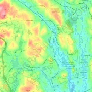
Name: Northbridge topographic map, elevation, terrain.
Location: Northbridge, Worcester County, Massachusetts, United States (42.09550 -71.70781 42.16579 -71.59262)
Average elevation: 364 ft
Minimum elevation: 210 ft
Maximum elevation: 666 ft
Other topographic maps
Click on a map to view its topography, its elevation and its terrain.
Shining Rock
United States > Massachusetts > Worcester County > Northbridge
Shining Rock, Northbridge, Worcester County, Massachusetts, 01534, United States
Average elevation: 371 ft