
Ferrières topographic map
Interactive map
Click on the map to display elevation.
About this map
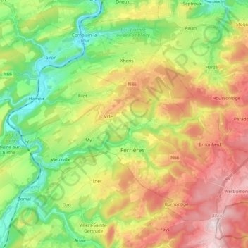
Name: Ferrières topographic map, elevation, terrain.
Location: Ferrières, Huy, Liège, Wallonia, 4190, Belgium (50.36529 5.51850 50.46008 5.70944)
Average elevation: 886 ft
Minimum elevation: 335 ft
Maximum elevation: 1,585 ft