
Rozos topographic map
Interactive map
Click on the map to display elevation.
About this map
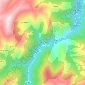
Name: Rozos topographic map, elevation, terrain.
Location: Rozos, Asturias, 33841, Spain (43.19929 -6.27975 43.23929 -6.23975)
Average elevation: 2,254 ft
Minimum elevation: 866 ft
Maximum elevation: 3,963 ft