
The Nation topographic map
Interactive map
Click on the map to display elevation.
About this map
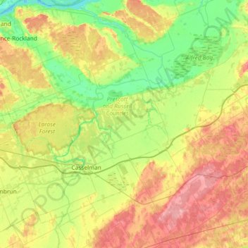
Name: The Nation topographic map, elevation, terrain.
Average elevation: 236 ft
Minimum elevation: 125 ft
Maximum elevation: 407 ft
Other topographic maps
Click on a map to view its topography, its elevation and its terrain.
Limoges
Canada > Ontario > Prescott and Russell Counties > The Nation > Limoges
Limoges, The Nation, Prescott and Russell Counties, Eastern Ontario, Ontario, K0A 2M0, Canada
Average elevation: 233 ft