
Los olivos topographic map
Interactive map
Click on the map to display elevation.
About this map
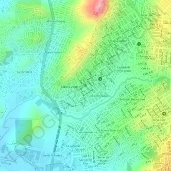
Name: Los olivos topographic map, elevation, terrain.
Location: Los olivos, Cúcuta, Norte de Santander, 540013, Colombia (7.90267 -72.54254 7.90277 -72.54244)
Average elevation: 942 ft
Minimum elevation: 755 ft
Maximum elevation: 1,352 ft
Other topographic maps
Click on a map to view its topography, its elevation and its terrain.
Carora
Colombia > Norte de Santander > Cúcuta
Carora, Cúcuta, Oriental, Norte de Santander, 540006, Colombia
Average elevation: 1,070 ft
Cúcuta
Colombia > Norte de Santander > Cúcuta
Cúcuta, Norte de Santander, 047, Colombia
Average elevation: 1,886 ft