
Scofield topographic map
Interactive map
Click on the map to display elevation.
About this map
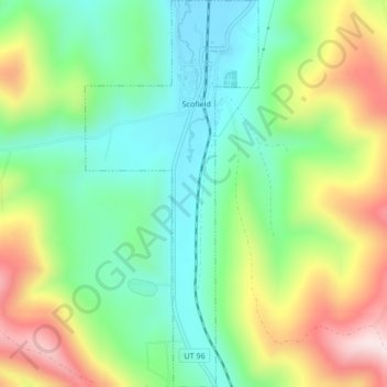
Name: Scofield topographic map, elevation, terrain.
Location: Scofield, Carbon County, Utah, United States (39.70045 -111.17285 39.73277 -111.15399)
Average elevation: 8,199 ft
Minimum elevation: 7,661 ft
Maximum elevation: 9,108 ft
Other topographic maps
Click on a map to view its topography, its elevation and its terrain.
Carbonville
United States > Utah > Carbon County
Carbonville, Carbon County, Utah, 84591, United States
Average elevation: 5,712 ft
Clear Creek
United States > Utah > Carbon County
Clear Creek, Carbon County, Utah, United States
Average elevation: 8,944 ft
Helper
United States > Utah > Carbon County
Helper, Carbon County, Utah, United States
Average elevation: 6,273 ft
Price
United States > Utah > Carbon County
Price, Carbon County, Utah, 84591, United States
Average elevation: 5,614 ft
Price
United States > Utah > Carbon County > Price > Price
Price, Carbon County, Utah, 84501, United States
Average elevation: 5,669 ft
Scofield Reservoir
United States > Utah > Carbon County
Scofield Reservoir, Carbon County, Utah, United States
Average elevation: 7,989 ft