
Stanwood topographic map
Interactive map
Click on the map to display elevation.
About this map
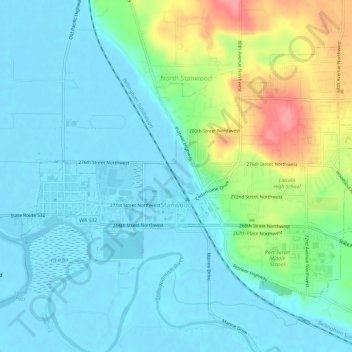
Name: Stanwood topographic map, elevation, terrain.
Location: Stanwood, Snohomish County, Washington, United States (48.23108 -122.37780 48.25961 -122.31922)
Average elevation: 66 ft
Minimum elevation: -7 ft
Maximum elevation: 272 ft
The city is located at the mouth of the Stillaguamish River, where it flows into Port Susan, an arm of the Puget Sound, and Skagit Bay, the mouth of the Skagit River. To the west is Davis Slough, which separates Stanwood from Camano Island, and forms the border between Snohomish and Island counties. Elevations in Stanwood range from 2 feet (0.61 m) above sea level near the Stillaguamish River to 190 feet (58 m) in the northeastern hills. The city is home to five creeks and drainage basins that flow into the Stillaguamish River and Puget Sound: Church Creek, Douglas Creek, Irvine Slough, the Skagit River, and the Stillaguamish River.:2-14 The Stanwood area was formed during the Pleistocene glaciation and was further shaped through the rise and fall of the sea level as well as sedimentary deposits from the Skagit and Stillaguamish rivers.:NF-9