
Byrdstown topographic map
Interactive map
Click on the map to display elevation.
About this map
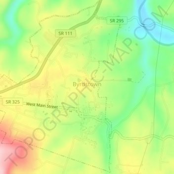
Name: Byrdstown topographic map, elevation, terrain.
Location: Byrdstown, Pickett County, Tennessee, United States (36.56073 -85.15448 36.58732 -85.12203)
Average elevation: 951 ft
Minimum elevation: 669 ft
Maximum elevation: 1,276 ft
Other topographic maps
Click on a map to view its topography, its elevation and its terrain.
Davidson
United States > Tennessee > Pickett County
Davidson, Pickett County, Middle Tennessee, Tennessee, 38577, United States
Average elevation: 1,076 ft