
Sulphur topographic map
Interactive map
Click on the map to display elevation.
About this map
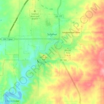
Name: Sulphur topographic map, elevation, terrain.
Location: Sulphur, Murray County, Oklahoma, United States (34.46089 -97.02980 34.53356 -96.94963)
Average elevation: 1,043 ft
Minimum elevation: 876 ft
Maximum elevation: 1,247 ft
Other topographic maps
Click on a map to view its topography, its elevation and its terrain.
Joy
United States > Oklahoma > Murray County
Joy, Murray County, Oklahoma, United States
Average elevation: 866 ft
Davis
United States > Oklahoma > Murray County
Davis, Murray County, Oklahoma, United States
Average elevation: 906 ft