
Muang Kham topographic map
Interactive map
Click on the map to display elevation.
About this map
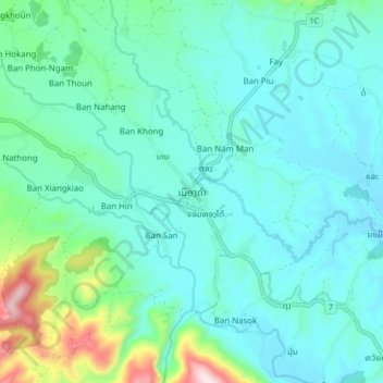
Name: Muang Kham topographic map, elevation, terrain.
Location: Muang Kham, Kham District, Xiangkhouang Province, Laos (19.59385 103.51941 19.67385 103.59941)
Average elevation: 2,106 ft
Minimum elevation: 1,814 ft
Maximum elevation: 3,458 ft