
La Toussuire topographic map
Interactive map
Click on the map to display elevation.
About this map
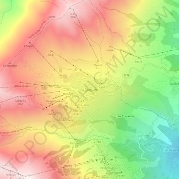
Name: La Toussuire topographic map, elevation, terrain.
Average elevation: 5,610 ft
Minimum elevation: 3,570 ft
Maximum elevation: 7,349 ft
Other topographic maps
Click on a map to view its topography, its elevation and its terrain.
Les Anselmes
France > Auvergne-Rhône-Alpes > Savoie > Fontcouverte-la-Toussuire
Les Anselmes, Fontcouverte-la-Toussuire, Saint-Jean-de-Maurienne, Savoie, Auvergne-Rhône-Alpes, France métropolitaine, 73300, France
Average elevation: 4,199 ft
Comborsiere
France > Auvergne-Rhône-Alpes > Savoie > Fontcouverte-la-Toussuire
Comborsiere, Fontcouverte-la-Toussuire, Saint-Jean-de-Maurienne, Savoie, Auvergne-Rhône-Alpes, France métropolitaine, 73300, France
Average elevation: 5,863 ft