
Crickhowell topographic map
Interactive map
Click on the map to display elevation.
About this map
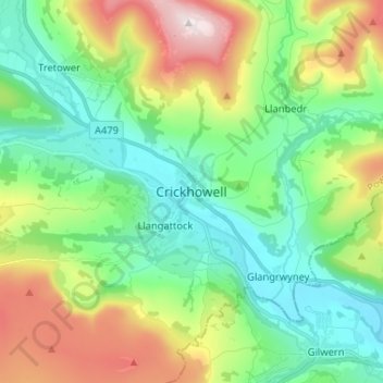
Name: Crickhowell topographic map, elevation, terrain.
Location: Crickhowell, Powys, Wales, NP8 1BJ, United Kingdom (51.81911 -3.17836 51.89911 -3.09836)
Average elevation: 830 ft
Minimum elevation: 161 ft
Maximum elevation: 2,300 ft