
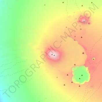
Tarso Toussidé تارسو توسيدي topographic map
Interactive map
Click on the map to display elevation.
About this map
Name: Tarso Toussidé تارسو توسيدي topographic map, elevation, terrain.
Location: Tarso Toussidé تارسو توسيدي, Tibesti, Chad (20.96871 16.20293 21.13928 16.56567)
Average elevation: 6,198 ft
Minimum elevation: 3,406 ft
Maximum elevation: 10,830 ft
Other topographic maps
Click on a map to view its topography, its elevation and its terrain.