
Landkreis Leipzig topographic map
Interactive map
Click on the map to display elevation.
About this map
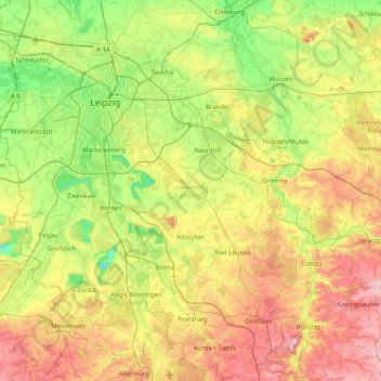
Name: Landkreis Leipzig topographic map, elevation, terrain.
Location: Landkreis Leipzig, Saksen, Duitsland (50.97887 12.14779 51.46870 12.94314)
Average elevation: 531 ft
Minimum elevation: 177 ft
Maximum elevation: 1,112 ft
Other topographic maps
Click on a map to view its topography, its elevation and its terrain.
Bad Lausick
Duitsland > Saksen > Landkreis Leipzig > Bad Lausick
Bad Lausick, Landkreis Leipzig, Saksen, 04651, Duitsland
Average elevation: 597 ft