
Shikoku topographic map
Interactive map
Click on the map to display elevation.
About this map
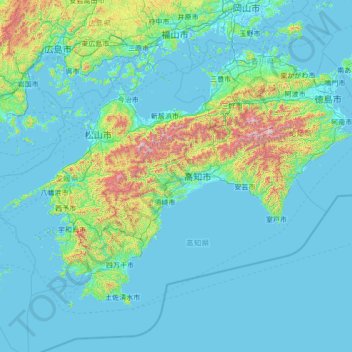
Name: Shikoku topographic map, elevation, terrain.
Location: Shikoku, 日高村, 高岡郡, Préfecture de Kōchi, Shikoku, Japon (32.72130 132.01267 34.40040 134.75027)
Average elevation: 512 ft
Minimum elevation: -16 ft
Maximum elevation: 6,171 ft