
Daniel Island topographic map
Interactive map
Click on the map to display elevation.
About this map
Name: Daniel Island topographic map, elevation, terrain.
Average elevation: 26 ft
Minimum elevation: -13 ft
Maximum elevation: 207 ft
Other topographic maps
Click on a map to view its topography, its elevation and its terrain.
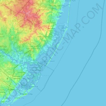
Long Beach Island
United States > New Jersey > Ocean County > Long Beach Township
Long Beach Island, Long Beach Township, Ocean County, New Jersey, United States
Average elevation: 13 ft