
Rurutu topographic map
Interactive map
Click on the map to display elevation.
About this map
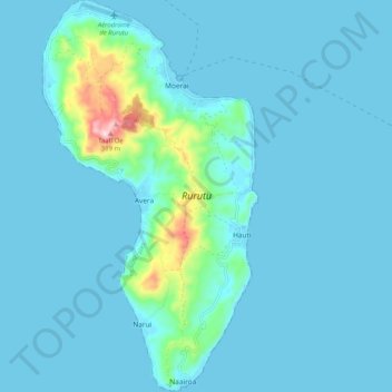
Name: Rurutu topographic map, elevation, terrain.
Average elevation: 105 ft
Minimum elevation: 0 ft
Maximum elevation: 1,191 ft
Other topographic maps
Click on a map to view its topography, its elevation and its terrain.
Rurutu
France > Polynésie française > Rurutu
Rurutu, Îles Australes, Polynésie française, 98753, France
Average elevation: 0 ft
Hauti
France > Polynésie française > Rurutu
Hauti, Rurutu, Îles Australes, Polynésie française, 98753, France
Average elevation: 157 ft