
Valle Nacional topographic map
Interactive map
Click on the map to display elevation.
About this map
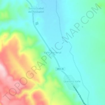
Name: Valle Nacional topographic map, elevation, terrain.
Location: Valle Nacional, Rodeo, Durango, México (25.03718 -104.51415 25.07718 -104.47415)
Average elevation: 4,770 ft
Minimum elevation: 4,452 ft
Maximum elevation: 5,551 ft
Other topographic maps
Click on a map to view its topography, its elevation and its terrain.
Francisco Zarco
México > Durango > Rodeo > Francisco Zarco
Francisco Zarco, Rodeo, Durango, México
Average elevation: 5,161 ft