
Parras de la Fuente topographic map
Interactive map
Click on the map to display elevation.
About this map
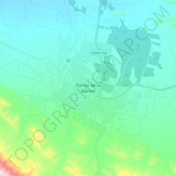
Name: Parras de la Fuente topographic map, elevation, terrain.
Location: Parras de la Fuente, Parras, Coahuila, México (25.40366 -102.21822 25.48366 -102.13822)
Average elevation: 5,062 ft
Minimum elevation: 4,642 ft
Maximum elevation: 6,936 ft
Other topographic maps
Click on a map to view its topography, its elevation and its terrain.