
Dogway topographic map
Interactive map
Click on the map to display elevation.
About this map
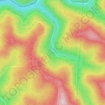
Name: Dogway topographic map, elevation, terrain.
Location: Dogway, Webster County, West Virginia, USA (38.22095 -80.39258 38.26095 -80.35258)
Average elevation: 3,593 ft
Minimum elevation: 2,848 ft
Maximum elevation: 4,232 ft
Other topographic maps
Click on a map to view its topography, its elevation and its terrain.
Cranberry Back Country
USA > West Virginia > Dogway
Cranberry Back Country, Dogway, Webster County, West Virginia, USA
Average elevation: 3,432 ft