Prato (Leventina) topographic map
Interactive map
Click on the map to display elevation.
About this map
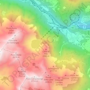
Name: Prato (Leventina) topographic map, elevation, terrain.
Average elevation: 5,758 ft
Minimum elevation: 2,628 ft
Maximum elevation: 8,819 ft

Click on the map to display elevation.
Name: Prato (Leventina) topographic map, elevation, terrain.
Average elevation: 5,758 ft
Minimum elevation: 2,628 ft
Maximum elevation: 8,819 ft