
Jelenia Góra topographic map
Interactive map
Click on the map to display elevation.
About this map
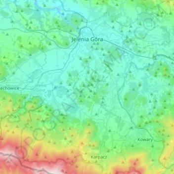
Name: Jelenia Góra topographic map, elevation, terrain.
Average elevation: 1,903 ft
Minimum elevation: 945 ft
Maximum elevation: 4,941 ft
Other topographic maps
Click on a map to view its topography, its elevation and its terrain.
Karkonosze
Poland > Lower Silesian Voivodeship > Jelenia Góra
Karkonosze, Jelenia Góra, Lower Silesian Voivodeship, Poland
Average elevation: 3,924 ft
Jelenia Góra
Poland > Lower Silesian Voivodeship > Jelenia Góra
Jelenia Góra, Lower Silesian Voivodeship, Poland
Average elevation: 1,699 ft