
Paragould topographic map
Interactive map
Click on the map to display elevation.
About this map
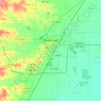
Name: Paragould topographic map, elevation, terrain.
Location: Paragould, Greene County, Arkansas, United States (35.98729 -90.59061 36.10455 -90.44014)
Average elevation: 299 ft
Minimum elevation: 220 ft
Maximum elevation: 489 ft
Other topographic maps
Click on a map to view its topography, its elevation and its terrain.
Marmaduke
United States > Arkansas > Greene County
Marmaduke, Greene County, Arkansas, 72443, United States
Average elevation: 285 ft
Crowleys Ridge State Park
United States > Arkansas > Greene County > Walcott
Crowleys Ridge State Park, Walcott, Greene County, Arkansas, United States
Average elevation: 354 ft