
Mount Makalu topographic map
Interactive map
Click on the map to display elevation.
About this map
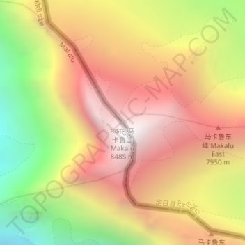
Name: Mount Makalu topographic map, elevation, terrain.
Location: Mount Makalu, Makalu, Sankhuwasabha, Koshi Province, Nepal (27.89139 87.08839 27.89149 87.08849)
Average elevation: 24,537 ft
Minimum elevation: 20,679 ft
Maximum elevation: 27,523 ft
Other topographic maps
Click on a map to view its topography, its elevation and its terrain.
Arun River
Nepal > Koshi Province > Sankhuwasabha > Num
Arun River, Makalu-02, Num, Makalu, Sankhuwasabha, Koshi Province, Nepal
Average elevation: 3,783 ft
landslide
Nepal > Koshi Province > Sankhuwasabha
landslide, Makalu, Sankhuwasabha, Koshi Province, Nepal
Average elevation: 12,493 ft