
Slijpe topographic map
Interactive map
Click on the map to display elevation.
About this map
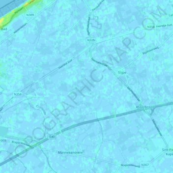
Name: Slijpe topographic map, elevation, terrain.
Location: Slijpe, Middelkerke, West-Vlaanderen, Vlaanderen, 8433, België (51.11848 2.79307 51.17993 2.87730)
Average elevation: 3 ft
Minimum elevation: -13 ft
Maximum elevation: 59 ft
Slijpe ligt in het West-Vlaams polderlandschap en wel op de middellandpolders. De hoogte bedraagt ongeveer 3 meter. Ten noorden van Slijpe loopt het Kanaal Plassendale-Nieuwpoort.
Other topographic maps
Click on a map to view its topography, its elevation and its terrain.
Wilskerke
België > Vlaanderen > Middelkerke
Wilskerke, Middelkerke, Oostende, West-Vlaanderen, Vlaanderen, 8431, België
Average elevation: 3 ft