
Pedro Gonzáles topographic map
Interactive map
Click on the map to display elevation.
About this map
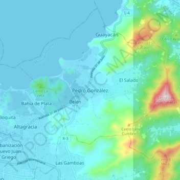
Name: Pedro Gonzáles topographic map, elevation, terrain.
Location: Pedro Gonzáles, Municipio Gómez, Nueva Esparta, Venezuela (11.07132 -63.95956 11.15132 -63.87956)
Average elevation: 315 ft
Minimum elevation: 0 ft
Maximum elevation: 2,198 ft