
Rogätz topographic map
Interactive map
Click on the map to display elevation.
About this map
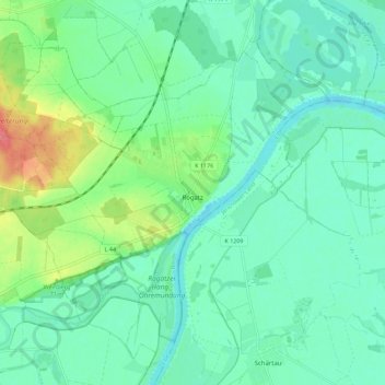
Name: Rogätz topographic map, elevation, terrain.
Location: Rogätz, Elbe-Heide, Börde, Saksen-Anhalt, 39326, Duitsland (52.28739 11.69629 52.34936 11.80578)
Average elevation: 151 ft
Minimum elevation: 95 ft
Maximum elevation: 308 ft