
Brasstown Bald topographic map
Interactive map
Click on the map to display elevation.
About this map
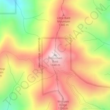
Name: Brasstown Bald topographic map, elevation, terrain.
Location: Brasstown Bald, Towns County, Georgia, United States (34.87431 -83.81110 34.87441 -83.81100)
Average elevation: 3,809 ft
Minimum elevation: 2,618 ft
Maximum elevation: 4,731 ft
Other topographic maps
Click on a map to view its topography, its elevation and its terrain.
Hiawassee
United States > Georgia > Towns County
Hiawassee, Towns County, Georgia, United States
Average elevation: 2,034 ft
Macedonia
United States > Georgia > Towns County
Macedonia, Towns County, Georgia, 30546, United States
Average elevation: 2,090 ft
Young Harris
United States > Georgia > Towns County
Young Harris, Towns County, Georgia, United States
Average elevation: 1,988 ft
Friendship
United States > Georgia > Towns County > Friendship
Friendship, Towns County, Georgia, United States
Average elevation: 2,051 ft