
Medora topographic map
Interactive map
Click on the map to display elevation.
About this map
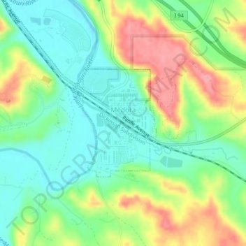
Name: Medora topographic map, elevation, terrain.
Average elevation: 2,362 ft
Minimum elevation: 2,238 ft
Maximum elevation: 2,559 ft
Other topographic maps
Click on a map to view its topography, its elevation and its terrain.
Theodore Roosevelt National Park
United States > North Dakota > Billings County
Theodore Roosevelt National Park, Billings County, North Dakota, United States
Average elevation: 2,480 ft