
Herk topographic map
Interactive map
Click on the map to display elevation.
About this map
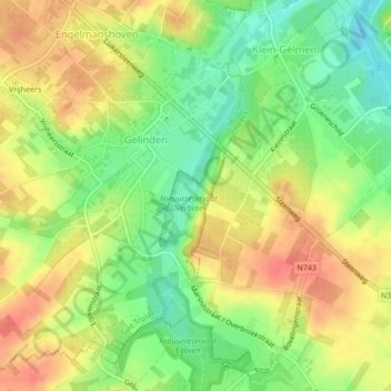
Name: Herk topographic map, elevation, terrain.
Location: Herk, Sint-Truiden, Hasselt, Limburg, Vlaanderen, 3870, België (50.75725 5.26415 50.76521 5.26818)
Average elevation: 272 ft
Minimum elevation: 180 ft
Maximum elevation: 351 ft
Other topographic maps
Click on a map to view its topography, its elevation and its terrain.
Duras
België > Vlaanderen > Sint-Truiden > Duras
Duras, Sint-Truiden, Limburg, Vlaanderen, 3803, België
Average elevation: 128 ft
Halmaal
België > Vlaanderen > Sint-Truiden
Halmaal, Sint-Truiden, Hasselt, Limburg, Vlaanderen, België
Average elevation: 200 ft