
Fonte Santa topographic map
Interactive map
Click on the map to display elevation.
About this map
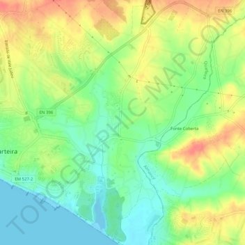
Name: Fonte Santa topographic map, elevation, terrain.
Location: Fonte Santa, Loulé, Faro, Algarve, 8125-303, Portugal (37.05587 -8.09783 37.09587 -8.05783)
Average elevation: 89 ft
Minimum elevation: -7 ft
Maximum elevation: 200 ft