
Honoli‘i Stream topographic map
Interactive map
Click on the map to display elevation.
About this map
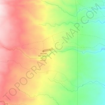
Name: Honoli‘i Stream topographic map, elevation, terrain.
Average elevation: 1,224 ft
Minimum elevation: 489 ft
Maximum elevation: 1,939 ft
Other topographic maps
Click on a map to view its topography, its elevation and its terrain.
Lake Waiau
United States of America (Island of Hawai'i territorial waters) > Hawaii > Hilo
Lake Waiau, Mauna Kea-Humu'ula Trail, Onizuka Center for International Astronomy, Hilo, Hawaiʻi County, Hawaii, United States of America (Island of Hawai'i territorial waters)
Average elevation: 12,871 ft