
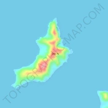
Dau Ac topographic map
Interactive map
Click on the map to display elevation.
About this map
Name: Dau Ac topographic map, elevation, terrain.
Average elevation: 23 ft
Minimum elevation: 0 ft
Maximum elevation: 367 ft
Other topographic maps
Click on a map to view its topography, its elevation and its terrain.
Île Pott
France > Nouvelle-Calédonie > Bélep
Île Pott, Bélep, Province Nord, Nouvelle-Calédonie, 98811, France
Average elevation: 49 ft
Île Art
France > Nouvelle-Calédonie > Bélep
Île Art, Bélep, Province Nord, Nouvelle-Calédonie, 98811, France
Average elevation: 59 ft