
Knowlton Lake topographic map
Interactive map
Click on the map to display elevation.
About this map
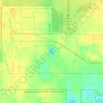
Name: Knowlton Lake topographic map, elevation, terrain.
Average elevation: 1,309 ft
Minimum elevation: 1,257 ft
Maximum elevation: 1,335 ft
Other topographic maps
Click on a map to view its topography, its elevation and its terrain.
Gaylord
United States > Michigan > Otsego County
Gaylord, Otsego County, Michigan, United States
Average elevation: 1,316 ft
Elmira
United States > Michigan > Otsego County
Elmira, Elmira Township, Otsego County, Michigan, 49730, United States
Average elevation: 1,276 ft
Vanderbilt
United States > Michigan > Otsego County
Vanderbilt, Corwith Township, Otsego County, Michigan, 49795, United States
Average elevation: 1,096 ft
Hayes Township
United States > Michigan > Otsego County
Hayes Township, Otsego County, Michigan, United States
Average elevation: 1,335 ft
Lake Marjory
United States > Michigan > Otsego County
Lake Marjory, Otsego Lake Township, Otsego County, Michigan, United States
Average elevation: 1,325 ft