
Tour d'Aï topographic map
Interactive map
Click on the map to display elevation.
About this map
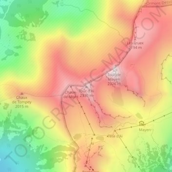
Name: Tour d'Aï topographic map, elevation, terrain.
Location: Tour d'Aï, Leysin, District d'Aigle, Vaud, 1854, Svizzera (46.37217 7.00189 46.37227 7.00199)
Average elevation: 6,040 ft
Minimum elevation: 4,190 ft
Maximum elevation: 7,543 ft