
Asuncion Island topographic map
Interactive map
Click on the map to display elevation.
About this map
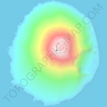
Name: Asuncion Island topographic map, elevation, terrain.
Average elevation: 558 ft
Minimum elevation: -3 ft
Maximum elevation: 2,782 ft
Other topographic maps
Click on a map to view its topography, its elevation and its terrain.
Anatahan Island
United States of America (CNMI) > Northern Mariana Islands
Anatahan Island, Northern Islands Municipality, Northern Mariana Islands, United States of America (CNMI)
Average elevation: 308 ft
Alamagan Island
United States of America (CNMI) > Northern Mariana Islands
Alamagan Island, Northern Islands Municipality, Northern Mariana Islands, United States of America (CNMI)
Average elevation: 486 ft
Agrihan
United States of America (CNMI) > Northern Mariana Islands
Agrihan, Northern Islands Municipality, Northern Mariana Islands, United States of America (CNMI)
Average elevation: 584 ft