

Bronx County topographic maps
Click on a map to view its topography, its elevation and its terrain.
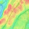




Roberto Clemente State Park
United States > New York > Bronx County > New York
Average elevation: 105 ft

North and South Brother Islands
United States > New York > Bronx County > New York
Average elevation: 13 ft

The Bronx
United States > New York > Bronx County > New York
The Bronx's highest elevation at 280 feet (85 m) is in the northwest corner, west of Van Cortlandt Park and in the Chapel Farm area near the Riverdale Country School. The opposite (southeastern) side of the Bronx has four large low peninsulas or "necks" of low-lying land that jut into the waters of the East…
Average elevation: 75 ft