
Verdigris topographic map
Interactive map
Click on the map to display elevation.
About this map
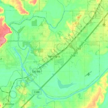
Name: Verdigris topographic map, elevation, terrain.
Location: Verdigris, Rogers County, Oklahoma, United States (36.19543 -95.74376 36.27858 -95.61490)
Average elevation: 600 ft
Minimum elevation: 505 ft
Maximum elevation: 817 ft