
Broadmoor topographic map
Interactive map
Click on the map to display elevation.
Broadmoor
Broadmoor is located at 29°56′56″N 90°06′15″W / 29.94889°N 90.10417°W / 29.94889; -90.10417 and has an elevation of 2 feet (0.6 m). According to the United States Census Bureau, the district has a total area of 0.56 square miles (1.5 km2). 0.56 square miles (1.5 km2) of which is land and 0.00 square miles (0.0 km2) (0.00%) of which is water.
About this map
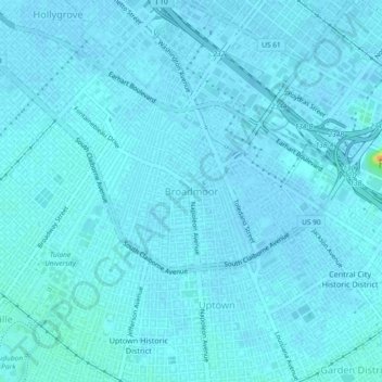
Name: Broadmoor topographic map, elevation, terrain.
Average elevation: 7 ft
Minimum elevation: -3 ft
Maximum elevation: 102 ft
Orleans Parish trails, hiking, mountain biking, running and outdoor activities