
Au Sable Forks topographic map
Interactive map
Click on the map to display elevation.
About this map
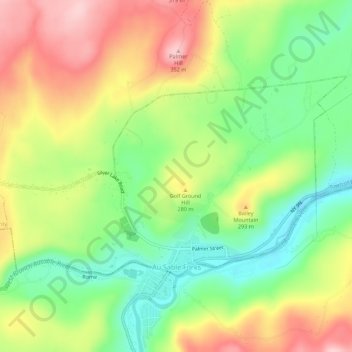
Name: Au Sable Forks topographic map, elevation, terrain.
Average elevation: 781 ft
Minimum elevation: 486 ft
Maximum elevation: 1,129 ft
Other topographic maps
Click on a map to view its topography, its elevation and its terrain.
Stevens Landing
United States > New York > Clinton County > Town of Black Brook
Stevens Landing, Town of Black Brook, Clinton County, New York, 12912, United States
Average elevation: 1,263 ft