
Pleasanton topographic map
Interactive map
Click on the map to display elevation.
About this map
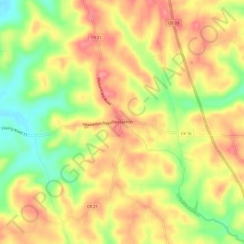
Name: Pleasanton topographic map, elevation, terrain.
Location: Pleasanton, Athens, Athens County, Ohio, United States (39.22063 -82.11320 39.26063 -82.07320)
Average elevation: 876 ft
Minimum elevation: 699 ft
Maximum elevation: 1,004 ft
Other topographic maps
Click on a map to view its topography, its elevation and its terrain.
Beaumont
United States > Ohio > Athens County > Athens
Beaumont, Athens, Athens County, Ohio, 45780, United States
Average elevation: 738 ft
Luhrig
United States > Ohio > Athens County > Athens
Luhrig, Athens, Athens County, Ohio, United States
Average elevation: 794 ft
Pratts Fork
United States > Ohio > Athens County > Athens
Pratts Fork, Athens, Athens County, Ohio, United States
Average elevation: 833 ft